The DynaCoast Project
Geomorphological mapping of Isfjorden coastal area
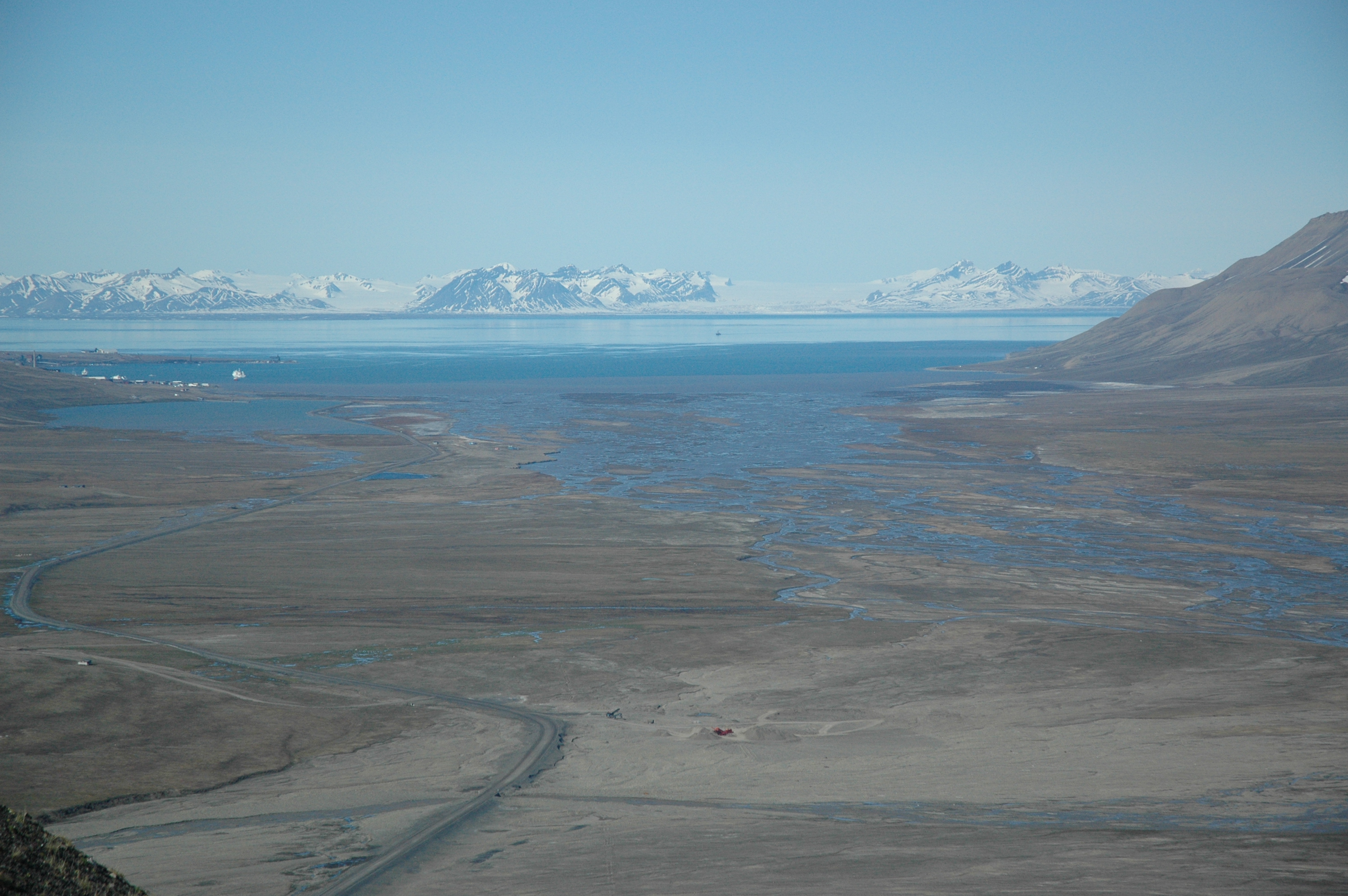
The DynaCoast project was initiated in response to the need for knowledge of fast coastal change in the Isfjorden area, combined with the lack of geomorphological maps to record and document coastal dynamics. There is a need for a geomorphological and sedimentological baseline for future research and monitoring of landscape and process change over time – since also topographic map data on Svalbard is are new and geomorphological data therefore is scarce.
Maps of landforms and sediment types in the coastal zone provide a useful tool for prediction and planning for current and future coastal change. There is a direct link between the types of landforms and sediments near the coast and the processes acting upon the coast, meaning that it is possible to identify areas where erosion is likely, where deposition and growth of e.g. deltas or tidal flats will happen. Behind the current coast are often traces of older coastlines. The landforms in these coastlines compared with along the present shore, provides information on changes in coastal processes over time (for example from depositional to erosional, or from fluvially dominated to more wave dominated). This allows us to develop understanding of which climatic or other environmental factors caused these changes to happen (for example changing sea level, changing sea ice cover, thawing permafrost, increased runoff), and which landform changes we can expect, if one or more of these parameters are changed in the future. This knowledge can be used to develop predictive tools for specific coastal areas, for example risk evaluations for cultural heritage) without continuous on-site monitoring.
Within the project we have produced:
- High resolution geomorphological and sedimentological maps of a 500 m wide zone inland from the coast around Isfjorden
- This website that will form a science and data-hub for researchers in the field of Svalbard arctic coastal systems, as well as working as a gateway to public access to coastal landform-, processes and sediment data for Svalbard
The new knowledge resulting from the project includes:
- Documentation and precise mapping of the range of variation of coastal landforms and sediment transport systems along the coasts of Isfjorden
- The development of an adapted workflow and adjusted and enhanced SOSI-coded system for arctic sediments and landforms, building on the standardised Norwegian SOSI-coded sediment mapping system for Quaternary geology
This new knowledge now provides the background for continued mapping of sediments, landforms and processes in different scales around Isfjorden and the potential to expand the map database to other parts of Svalbard. Following the framework resulting from the DynaCoast project such work can be continued in a standardised and homogenous way.
Important scientific findings from this work is how certain landforms preferentially occur together and how sediment transfer systems (slopes and rivers) determines the coastal development and change at any site. This knowledge is crucial to enable any deeper understanding of how the systems have varied back in time and under the influence of future changes.
The fact that upstream processes affect the coastline is not new, but the documentation of how these systems interact in a Svalbard context is. Understanding the typical building blocks the Svalbard coastline is made of and their internal links and variation can provide the background for knowledge-based decisions relating to protection and planning around near coastal infrastructure, cultural heritage and environmental protection of e.g. areas of mudflats attracting bird life. The data also allow for better understanding of potential changes in sediment supply systems to the fjords which affects nutrient supply but also suspended sediment prohibiting light penetration to the water coloumn.
Knowledge gap and relevance for management of environment and cultural heritage
Compared to more populated places, official mapping of Svalbard has a short history, and the precision of geographical positions on older maps is low. The possibility to understand and quantify landscape change over time through existing maps is therefore very limited. Topographic maps show the position of the shoreline at the time of mapping, but especially shallow water areas in inner fjords and near the coast, are poorly covered, and can also change quickly. The same is true for areas prone to coastal erosion or rapid migration of sandy spits or muddy areas (deltas or tidal flats in front of river mouths).
Geological maps of the bedrock of Svalbard exist (Norwegian Polar Institute), and while the composition of bedrock does matter for easily erosion along the coast occurs and the mineral composition of sediment flux to the sea, it does not translate to behaviour of the surface sediments.
Published Geomorphological and Quaternary geological maps (surface sediment cover and landforms) exist for Adventdalen (Tolgensbakk et al, 2000, scale 1:100 000), Braganzavågen (Rubensdotter et al., 2016 and Larsen et al., 2016) and select areas prone to slope related geohazards; Bjørndalen-Vestpynten (Rubensdotter et al., 2015, scale 1:15 000, financed by Svalbard Environmental fund) and Todalen, Gangdalen, Bødalen (Rubensdotter et al., 2012, scale 1:25 000, financed by Svalbard Environmental fund). In addition, Rubensdotter have produced more small, unpublished, maps over Foxdalen, Vindodden etc. The coastal zone was not the primary focus of any of those maps and has been mapped in low and varying level of scientific detail. When the DynaCoast project started, no previous map existed of the geomorphology of the coastal zone of wider parts of Isfjorden.
In addition, a few maps of coastal or near-coastal areas exist in from very small areas in different types and scales from local dynamics research projects for e.g. Dicksonfjorden, Sassen around Fredheim and Petuniabukta. These maps are typically relating to specific research questions and are not standardised and occur either as figures in scientific publications, theses or are not publically available. They use different classifications and scales and are important for understanding detailed local development and particular local features but are not well adapted to large scale coastal management questions.
Methods, data format and accessibility
The DynaCoast project, although small in budget and hours, was groundbreaking in the sense that nothing like this had been done on Svalbard (and very few places in the Arctic) previously. Animportant part of the work has been to develop procedures for how such work should be done and customize systems, so future mapping can follow a streamlined, standardised and tested routine. We originally proposed to produce a paper map in 1:30.000 for the coast along Isfjorden and make the digital geodata accessible in addition. An idea that originated from the previous map sheet publications from smaller areas with focus on the entire surface sediment system for the map sheet. This quickly proved not to be the ideal format(s) for the DynaCoast data.
- The size, scale and narrow coast focus proved to comprise 34 separate potential pdf map sheets, which would not make sense to produce individually neither financially nor for lack of context in each map sheet
- Public storage of surface sediment for Svalbard geodata is not covered by the existing digital database infrastructure with public access and staff to handle requests
We have created the SVALCOAST Science HUB webpage for direct communication with the users of open access DynaCoast data and access to flexible formats. All material exists digitally as feature classes in an ArcGIS geodatabase format, but we expect to continually add details/areas as areas are revisited or expanded in connection with future projects. An added benefit of a digital hub is that this also can be used for compiling relevant coastal data collected in other projects. The map geodatabase is currently stored by this projects researchers at UNIS and PDF files of the digitised areas are uploaded progressively to the webpage. First priority has been given to areas frequently visited from Longyearbyen, which also document representative variation in coastal geomorphology for the Isfjorden area. Examples of the pdf files are shown under maps. There are different options for how to present the maps depending on the purpose, and several parametres, such as scale, can be modified, see examples under map options.
References
– Tolgensbakk, J., Sørbel, L. & Høgvard, K. 2000: Adventdalen. Temakart 32. Geomorphological and Quaternary geological map, Svalbard 1:100,000, Spitsbergen sheet C9Q, Norsk Polarinstitutt
– Rubensdotter, L., Larsen, E. and Lyså, A. 2016: Quaternary geological and geomorfological map, Svea, Svalbard. 1:15 000. Norges geologiske undersøkelse, NGU.
– Larsen, E., Farnsworth, W.R., Høgaas, F., Lyså, A. and Rubensdotter, L., 2016: Quaternary geological and geomorfological map, Svea, Svalbard. 1:70 000. Norges geologiske undersøkelse, NGU.
– Rubensdotter, L., Romundset, A., Farnsworth, W.R. and Christiansen, H.H. 2015: Landforms and sediments in Bjørndalen-Vestpynten, Svalbard. Quaternary geological map, 1:10 000. Geological survey of Norway. English and Norwegian version.
– Rubensdotter, L. 2012: Landforms and sediments in Todalen and upper Bø- and Gangdalen, Svalbard. 1:25 000. Including popular science description. NGU and UNIS. English and Norwegian version.
The Catchment to Coast project (C2C)
Understanding the coastal changes in Adventdalen/ Adventfjorden.
The C2C project monitors the impact of climate change on terrestrial, coastal and marine ecosystems. C2C concentrates on four fjord systems, three on mainland Norway and one on Svalbard, with many institutes, universities and research centres involved.
